


logo

Samarkand 2

Загружено в:

10.08.2023

Скачано:

0

Размер:

2399.9658203125 KB
  SAMARKAND
                                                                            
Samark h
an          TABLE OF  CONTENT

History

Geography 

Borders

Industy

Economy 

Administrative  divisions

Registan Mosque 

Climate  

Fauna & Flora  
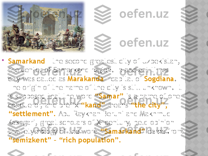
Samarkand  – the second greatest city of Uzbekistan, 
the center of Samarkand region. In ancient times 
city was called as  Marakanda  – capital of  Sogdiana . 
The origin of the name of the city is still unknown. It 
is supposed that the word  “Samar”  is a name of one 
conqueror, and prefix  “kand”  means  “the city”, 
“settlement”.  Abu-Raykhan Beruni and Makhmud 
Kashgari, great scholars of XI century, held opinion 
that etymology of the word  “Samarkand”  came from 
“semizkent” – “rich population”.  GEOGRA PHY   A N D  CLIMATE
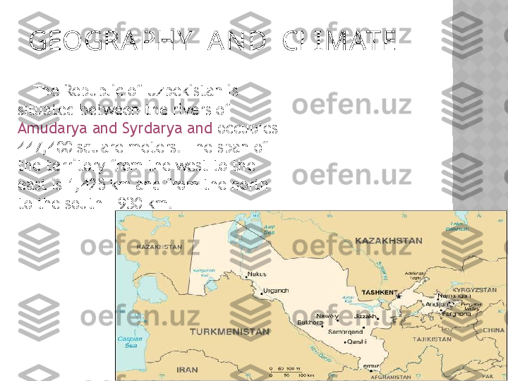
       The Republic of Uzbekistan is 
situated between the rivers of 
Amudarya and Syrdarya and  occupies 
447,400 square meters. The span of 
the territory from the west to the 
east is 1,425 km and from the north 
to the south - 930 km.   THE    BORDERS
       The borders: The territory borders on 
Kazakhstan in the north , on  Kyrgyzstan  and 
Tajikistan in the east and southeast , on 
Turkmenistan in the west , and on  Afghanistan  
in the south . The length of the border with 
Afghanistan is 137 km , with Kazakhstan - 
2,203 km, with Kyrgyzstan - 1,099 km, with 
Tajikistan - 1161 km, and with Turkmenistan - 
1,621 km.  
Samarqand Province  also has significant  natural 
resources, including construction materials such as 
marble, granite, limestone, carbonate , and  chalk . 
The Province's major agricultural activities are 
cotton and  cereal growing, winemaking and 
sericulture. In terms of industry, metal processing 
(spare parts for automobiles and combines), food 
processing, textiles, and ceramics industries are the 
most active in the area.

The province has  a well-developed transport 
infrastructure , with over  400 km of railways and 
4100 km of surfaced roads . The telecommunication 
infrastructure is also well developed.   
Indust ry                             Economy
     The  economy of Samarkand is based primarily on 
agriculture  and  industry.  Agriculture-related 
enterprises include the processing of  silk  and 
cotton, fruit canning , and the production of  wine, 
clothing ,  leatherware and footwear, and tobacco . 
Metalworking and machinery production are leading 
industries.  ADMINISTRATIVE DIVISIONS

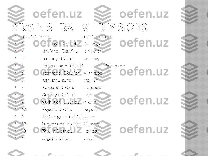
District name               District capital

1 Bulungur District Bulungur

2 Ishtikhon District Ishtikhon

3 Jomboy District Jomboy

4 Kattakurgan District Paishanba

5 Koshrabot District Koshrabot

6 Narpay District Oqtosh

7 Nurobod District Nurobod

8 Oqdarya District Laish

9 Pakhtachi District Ziadin

10 Payariq District Payariq

11 Pastdargom District Juma

12 Samarqand District Gulabad

13 Toyloq District Toyloq

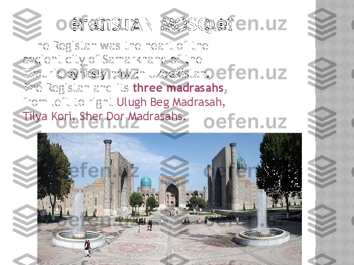
14 Urgut District Urgut          REGISTAN MOSQUE
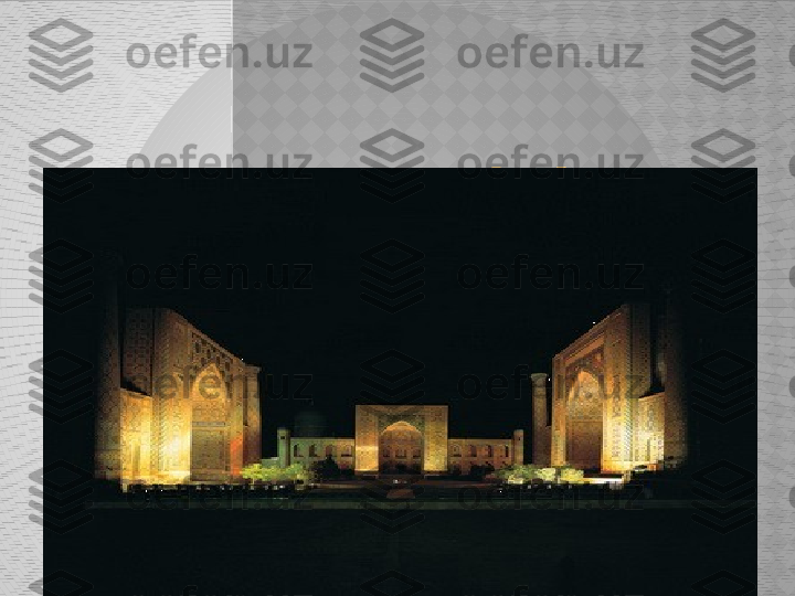
      The Registan was the heart of the 
ancient city of Samarkhand of the 
Timurid dynasty now in Uzbekistan. 
The Registan and its  three madrasahs , 
from left to right  Ulugh Beg Madrasah, 
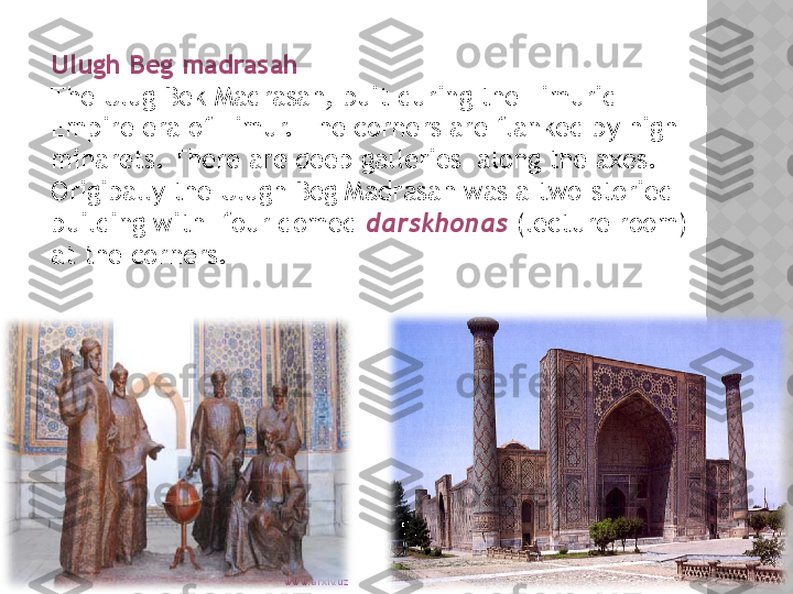
Tilya Kori, Sher Dor Madrasahs.  www.arxiv.uzUlugh Beg madrasah 
The Ulug Bek Madrasah, buit during the Timurid 
Empire era of Timur. The corners are flanked by high 
minarets. There are deep galleries  along the axes. 
Origibally the Ulugh Beg Madrasah was a two-storied 
building with  four domed  darskhonas  (lecture room) 
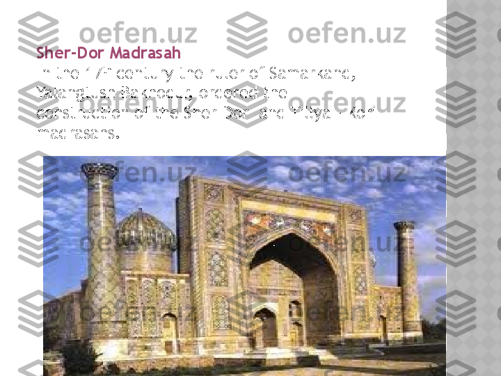
at the corners.  www.arxiv.uzSher-Dor Madrasah 
In the 17 th
 century the ruler of Samarkand, 
Yalangtush Bakhodur, ordered the 
construction of the Sher-Dor  and Tillya – Kori 
madrasahs.  www.arxiv.uzTilya-Kori Madrasah
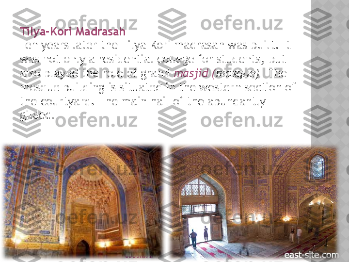
Ten years later the Tilya-Kori madrasah was built. It 
was not only a residential college for students, but 
also played the role of grand  masjid ( mosque).  The 
mosque building is situated in the western section of 
the courtyard. The main hail of the abundantly 
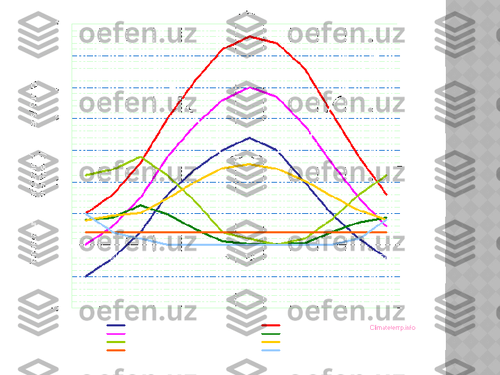
gilded .      Climate:  The climate of Uzbekistan is  sharply 
continental,  characterized by high amplitude 
of day and night , summer and winter 
temperatures. The temperature varies rather 
considerably with respect to the seasons. 
Average temperature in January falls below -6 
0C, while the average temperature in  July, May 
rise  above +32 0C . Average annual atmospheric 
precipitation on the plains is 120-200 mm, in 
mountainous areas - 1000 mm. The amount of 
precipitations is low, which is why the 
agriculture relies on irrigation to a great 
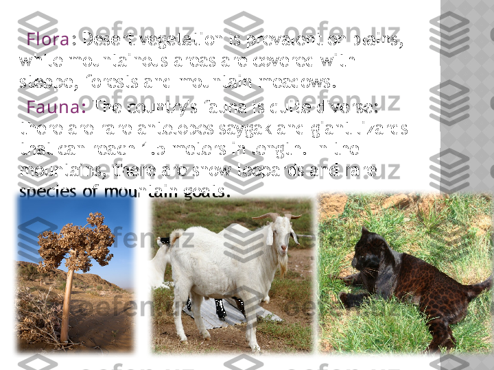
degree.         Fl ora : Desert vegetation is prevalent on plains, 
while mountainous areas are covered with 
steppe, forests and mountain meadows.
     Fauna :  The country's fauna is quite diverse: 
there are rare antelopes saygak and giant lizards 
that can reach 1.5 meters in length. In the 
mountains, there are snow leopards and rare 
species of mountain goats.
 

SAMARKAND

Samark h an

TABLE OF CONTENT  History  Geography  Borders  Industy  Economy  Administrative divisions  Registan Mosque  Climate  Fauna & Flora

 Samarkand – the second greatest city of Uzbekistan, the center of Samarkand region. In ancient times city was called as Marakanda – capital of Sogdiana . The origin of the name of the city is still unknown. It is supposed that the word “Samar” is a name of one conqueror, and prefix “kand” means “the city”, “settlement”. Abu-Raykhan Beruni and Makhmud Kashgari, great scholars of XI century, held opinion that etymology of the word  “Samarkand”  came from “semizkent” – “rich population”.

GEOGRA PHY A N D CLIMATE The Republic of Uzbekistan is situated between the rivers of Amudarya and Syrdarya and occupies 447,400 square meters. The span of the territory from the west to the east is 1,425 km and from the north to the south - 930 km.